Bentley Systems is very serious about point clouds. In the last twelve months alone it acquired Pointools and added powerful point cloud capabilities to Descartes and ProjectWise. It now regards the laser scanning output to be a fundamental data type, just like DGN. AEC Magazine found out why.
As the AEC industry moves to modelling, analysis and new design processes, 3D data is becoming much more commonplace. But it is not all about Building Information Modelling (BIM). Laser scanners and the 3D point clouds they generate have also become an industry hot topic.
While laser scanners are still expensive, many surveyors use them regularly for civil engineering, process plant and architecture projects. CAD software vendors, including Bentley and Autodesk, have added support for point clouds within their core design packages. AEC professionals can import and work with the 3D data.
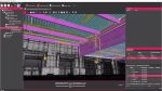
The challenge with point clouds is that they are typically very large. Laser scanners measure millions of 3D points in seconds and to cover a wide area, a number of scans are combined, leading to gigabytes of data per survey. Also, while in a viewer the file may seem like a 3D capture of a site, the data is ‘dumb’, just a whole load of raster points. To generate a CAD model from this takes a lot of skill and experience and for a CAD package to properly display and provide editing tools requires serious software engineering.
For many years Pointools was one of the leading developers of point cloud display and editing. Its products made light work of manipulating huge point clouds and offered editing tools to manipulate and make sense of all those 3D dots.
The driving force behind Pointools was Faraz Ravi, a former architect, who got into programming and developed the product alongside a surveying company in North London. In 2011, Bentley Systems acquired Pointools and made Mr Ravi its director of product management for point clouds.
This month the AEC editorial team caught up with Mr Ravi, Richard Zambuni, global marketing director, geospatial and utilities, and Benoit Fredericque, Bentley product manager, MicroStation/Descartes Point Cloud, 3D City GIS, to discuss Bentley’s journey through the point clouds.
Integrating point clouds
Like many AEC software developers, it did not take long for Bentley to realise just how important point clouds were going to be in its users’ workflows.
Three years ago it licensed the Vortex engine from Pointools and implemented it inside all its MicroStation-based products.
This was a passive implementation. It allowed its users to view and manipulate point clouds inside the familiar MicroStation environment, using what is widely regarded to be the industry’s fastest point cloud engine, but didn’t really provide a processing environment.
Building on this foundation, Bentley’s next step was to provide tools to process point clouds within MicroStation. And it decided that Bentley Descartes was going to be the product to do this in.
At first look, Descartes may seem like an odd choice. Originally developed as a 2D raster management, clean up and raster to vector conversion tool, the MicroStation add-on made its name in mapping, GIS and civil engineering. But, once you consider Bentley’s wider strategy for working with point cloud data, it makes more sense.
Bentley sees point clouds as a fundamental data type and wants its users to use point clouds just like any other data type. Just as Descartes first enabled raster data to be used and processed within any MicroStation-based product, the recently launched V8i (SELECTseries 3) release of Descartes now offers similar functionality for point cloud data.
In parallel to these new developments in Descartes Bentley was also on the look out for technology to enhance its in-house capabilities. This happened in November 2011 with its acquisition of Pointools.
Descartes vs Pointools
Pointools is a standalone application for clean up and processing of point clouds. It is used when workflows are more point cloud-centric or when data needs to be prepared for downstream use.
Descartes runs inside MicroStation, Bentley’s design and engineering environment. It is used in workflows where a combination of point cloud and CAD geometry models are required.
While this brought the Pointools family of point cloud processing software into Bentley’s product portfolio, it also helped Bentley address the major challenge of how to manage huge point cloud files.
On the desktop handling gigabytes of data is not so much of a challenge, but in a server or web-based environment moving these huge files around can take a long time. And sometimes it just isn’t practical.
Bentley has been working with the Pointools development team on a ProjectWise module called ProjectWise point cloud streaming service, which allows firms to manage, segment and stream point clouds into a client session. This could be MicroStation, Bentley Navigator or the Bentley Navigator V8i for iPad app. Suddenly point clouds can be everywhere.
The fundamental data type
Just like a DGN or a 2D raster image, Bentley considers a point cloud to be a class one model, a fundamental data type. With this in mind it encourages the direct use of point clouds in engineering workflows in building, plant and civils applications. Just like a 2D raster file they can add context, be used as a backdrop for digitising and can also be edited.
This approach is different to the one taken by a lot of hardware and software vendors, which regard point clouds as a survey format and think they need to be turned into something else before they are useful. This could be 3D CAD data or, the current industry favourite, fully loaded BIM models.
Bentley regards scan-to-BIM to be a valid workflow, but thinks the point cloud representation should only be escalated when required — on demand. In any one project a BIM model may only be required for a single faade, while the rest of the data is kept as a point cloud for context.
To help support its so-called fundamental data type, Bentley is keen to point out that all of its point cloud capable products share a common data format, POD, which is the native format of Pointools. This means Bentley users do not have to convert into different representations, which can be a very lengthy process.
Another key element of Bentley’s point cloud strategy is helping its customers reuse their MicroStation skills and knowledge. For example, in order to get the element properties simply click on a point; to increase the point size, increase the line thickness; to clip a point cloud, use the standard clipping tools; and to snap, the standard snapping tools.
Bentley Pointools
While Bentley acquired Pointools in November 2011, it is still in the process of integrating Pointools Edit into its portfolio. This will happen later this year with the release of Bentley Pointools, an enhanced version of the software.
Bentley Pointools is a standalone application and is designed specifically for point cloud centric workflows, for processing, cleanup, visualisation and animation.
Point cloud data can be imported from a number of different formats, including proprietary formats from laser scanner manufacturers, Riegl, Faro, Leica and others. Once inside, data can be pre-processed, to reduce noise or change the colour of points. As the laser scan data is accurate, it is possible to take exact measurements. There are also some smart tools for point selection.
In terms of CAD data, Pointools can work with 2D and 3D data, but support is fairly limited, including 3ds and 2D DWG. CAD data import is sufficient for visualisation purposes, but if you want to start looking at engineering data, you really need an engineering package like MicroStation or Descartes. Interestingly, there is no support for DGN yet, but this should change soon.
One of the key features in Pointools is its ability to segment data down in order to make point clouds easier to work with. This is not necessarily for performance, as the software’s view-based streaming is very efficient at dealing with large models, but more from a visualisation point of view. Segmentation can be done by gridding up the data up into cells, or into more logical sections. A typical workflow is to place segments on different layers.
Layers can also be used to help clean up noise and obstructions. For example, temporarily remove the exterior of a building in order to get access to the interior. Layers are also useful for exporting chunks of data out in multi user workflows.
In Pointools Edit the number of layers is limited to seven, but with Bentley Pointools this will increase to 128. This should have a big impact on workflow, offering users much more flexibility.
Another new feature for Bentley Pointools will be the ability to transform objects and manipulate them much more freely. In Pointools Edit moving objects is a little clunky and requires the user to type in values. With Bentley Pointools, this can be done much more readily, with the user directly moving objects around in the viewport. Here, the Pointools smart selection tools pay dividends.
In the context of a factory, an example could be the repositioning of a piece of machinery on the shop floor. For a building, a new HVAC component could be scanned in the yard and brought into the point cloud of the as-built building virtually. The common theme in both of these examples is users do not have to work with vector-based CAD data if they do not want to. If a CAD model does not exist, why not work with the point cloud directly?

Bentley Descartes
All MicroStation-based products include the Pointools Vortex engine, which offers basic functionality for manipulating point cloud data, including view, clip and measure.
Bentley Descartes builds on this foundation, helping users get a whole lot more out of point cloud data in the context of CAD or engineering workflows. There are two main use examples. Firstly, to extract features and create a new geometry model and, secondly, to manipulate a point cloud model inside an engineering model.
As an application, Bentley Descartes layers on top of anything that is MicroStation-based. This includes MicroStation PowerDraft, AECOsim for building design, plus all of the Bentley civil products. It is seamlessly integrated into these applications with a set of toolboxes appearing in the familiar MicroStation user interface.
Descartes includes a suite of point cloud centric tools that can be used in many industries. In short, they make it much easier to extract geometry, snap on point clouds and understand where you are in the point cloud. We will look at each of these in turn.
Classification editing: In civil engineering workflows in particular, point cloud classification can be extremely important. It helps users isolate and work with specific parts of a model. For example, ground, building, vegetation and water.
Classification usually requires specialist software, such as the MicroStation-based tool Terrasolid, and is often done by the surveyor prior to delivering the point cloud dataset. Sometimes, mistakes can occur during this process and adjustments need to be made. For example, vegetation may have been wrongly classified as ground or there may be unwanted noise. Descartes offers simple editing tools, which help isolate and remove points that have been wrongly classified.
In terms of workflow, this can be extremely useful when an engineer wants to create a Digital Terrain Model (DTM) from point cloud ground data. Doing the work up front reduces the need for surface terrain filtering post processing.
Drape lines: This neat tool allows users to drape a line on a point cloud surface with a view to using that vector geometry downstream. It is relevant to all AEC disciplines, but is particularly useful in civil engineering when extracting road geometry.
For example, in order to produce a road cross-section, traditional workflows require users to cut through a point cloud and trace the section manually. Now with Descartes, users can create an array of lines in MicroStation, drape them across a point cloud surface and it is done automatically. Cross sections can then be used inside a civil engineering design tool such as InRoads or MX.
This same process can be applied to road alignments as well as other key AEC features including railways and buildings.
Point Cloud Visual Explorer: A big challenge when working with point clouds is how to properly understand the 3D scene. Zoom out and you do not see the detail, but zoom in and it actually reduces the global understanding of what you are looking at. Simply speaking, this is because there are larger gaps between the points.
To address this Bentley has developed the visual explorer, which dynamically re-colours points within a 3D cursor, based on their 3D location and direction. This can help give a better understanding of the 3D point cloud model without having to change view or zoom level. For example, to better understand the details in a building or a plant, or to find the breaklines in a civil engineering model.
Visual Explorer can also help access the quality of the point cloud data and looks to be a very powerful technology. It comes as no surprise to learn that Bentley has a patent pending.
Smart snap: Using a similar principle to the 3D cursor in visual explorer, Smart Snap is able to isolate key points in the point cloud (such as the lowest, highest or average). This could be as part of a digitising workflow or simply as a starting point for a new design.
Smart Snap can be used in a number of ways, including finding the lowest point that corresponds to a break line or when assessing clearance. e.g. measuring the lowest point on a bridge and the highest point on the road beneath.
Of course, there is a whole lot more to Descartes than the new point cloud tools. The software also includes a range of bread and butter tools for raster image processing, cleanup and vectorisation. Plus, the new Descartes V8i (SELECTseries 3) release can create and use scalable terrain models, which is particularly useful for large scale terrains.
Clash detection
Bentley has big plans for point cloud data and claims to have some compelling clash detection technology in the pipeline.
Bentley could not confirm how it is being brought to market yet, but said that the technology is unique in that it has compelling performance and everything happens in real time. Clash checks can be performed between multiple point clouds and between point cloud and 3D CAD model.

This could be a very powerful tool for retrofit work and all types of AEC projects.
ProjectWise Point Cloud Services
One of the biggest point cloud developments this year came inside ProjectWise, Bentley’s information management and collaboration software that forms the backbone for many of the world’s leading construction projects.
Serving up huge gigabyte point cloud data files in their entirety is not practical across multiple sites, so ProjectWise is now able to stream in data on-demand.
For a file of a gigabyte or more, it may only take a few seconds before the point cloud becomes visible. To start, this is a low-density representation, but as the user zooms in, the density increases with data streaming in depending entirely on the viewpoint.
Bentley had to fundamentally rework the way a point cloud model is served up and confirms this would not have been possible without the Pointools acquisition.
Streaming of point cloud data will be supported in a number of products, including MicroStation, Bentley Navigator and the Bentley Navigator V8i for iPad app.
Conclusion
CAD software developers know that point clouds are becoming an increasingly common data type for customers. Both Bentley and Autodesk are acquiring and implementing new 3D capture and manipulation technologies with each release of their products.
One of the key take-aways from our conversation with Bentley is that point cloud data does not always have to be converted. There is a time cost in doing this and it is not always of benefit.
In the future, we expect project models to combine data in multiple formats, residing in the right one for the job it does. Editing and viewing tools must become more open to displaying and accessing data from a variety of sources.
While Bentley has put point cloud in the foundation MicroStation layer it is also thinking about their management. File sizes are not getting any smaller and storage and distribution is already a major headache for point cloud consumers.
Bentley has identified this and is actively enhancing ProjectWise to remove a lot of that pain through intelligent streaming technology. AEC Magazine thinks this will be an important game changer for increasing the popularity of point clouds within the design process.
For now, working with point clouds will still require a combination of products to provide each project member with the correct part of the model that they need. There are clear scan, clean/edit, manage and use phases which can not be done currently by any one product. Here Bentley has Pointools for standalone preparation, ProjectWise for management and Descartes to integrate the point cloud into engineering projects.
While Bentley has many flexible offerings in terms of licensing products and swapping product mixes, Pointools is not yet part of the portfolio, so we look forward to Bentley Pointools coming out later this year as scheduled.
When Bentley Systems acquired Pointools many customers were worried as Pointools was a key independent player in the industry. The acquisition has certainly stopped or delayed expected products such as Pointools for Revit and most certainly stopped development of Pointools for Rhino. This is obviously bad news for the greater industry.
However Bentley did not acquire Pointools just to stop others from having it, or to sit on it, as the development work and integration with ProjectWise that we have seen demonstrates. Bentley is very serious about laser scanned data and the benefits its customers could get by using it.
Next year Autodesk will include technology it acquired from its Alice Labs in AutoCAD and with its concentration on the cloud, it will be interesting to see how the two companies’ solutions compare.