Satsense converts satellite data every six days and offers historical snaps shots going back to 2015
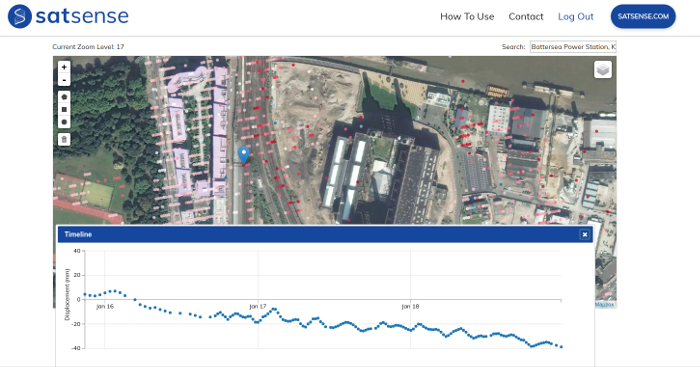
Satsense, a spin out from the University of Leeds, has recently launched a service that measures incremental vertical ground movement to a +/- 1mm accuracy, based on satellite readings from the European Space Agency satellite, Sentinel 1.
The company is targeting the construction, geotechnical, property conveyancing and insurance industries, as well as large infrastructure owners such as Highways England, Network Rail and Water Utilities. The technology can be used as a preventative maintenance solution for large assets such as dams, water, and gas pipelines.
Satsense data is stored online and automatically updated every six days. It goes back to 2015 so firms can explore how infrastructure may have moved over the last four years.
Through the online portal, subscribers can investigate any site of interest in the UK. SatSense provides example data for London and Stoke via its website.
If you enjoyed this article, subscribe to our email newsletter or print / PDF magazine for FREE